£260.00 £289.17
The Automatic Identification System (AIS) is a shipboard broadcast VHF transponder system, sending data about the identity of a ship. Its name, MMSI number, its latitude, longitude, speed, course and heading. All vessels over 300 gross tonnage and all passenger vessels are obliged to carry an AIS transponder. This transponder assists in traffic monitoring, management and collision prevention. The data is sent continuously and is useful to yachtsmen, particularly in busy shipping areas.
The Nasa Marine AIS radar is the first stand alone AIS receiver / plotter specifically designed for the leisure boat market. The unit consists of a dual frequency AIS receiver, demodulator, signal processor and a backlit matrix display. It receives an NMEA input (RMC) from the boats GPS which puts the user at the centre of a radar style screen. A COG pointer is selectable by the user. All AIS carrying vessels and SART transponders are displayed with bearing and range relative to the user. Any vessel on the screen can be selected by the user. The selected vessel is highlighted and its data displayed on the right of the screen. This data includes the vessel's MMSI number, name, course over ground, speed over ground, range, latitude and longitude.
The display, with ranges of 0.125, 0.25, 0.5, 1, 2, 4, 8, 16 and 32 nautical miles shows AIS carrying vessels and SART transponders in a format normally associated with conventional radar. A trail of previous positions clearly chows the relative track of all the targets on the screen. A box to the right of the screen displays the speed over the ground, the vessel name, mmsi number and the latidude and longitude of any target selected by the user. As each vessel leaves a trail of previous positions the user can instantly see its relative position and bearing. Should any vessel cause concern (particularly if there is a risk of collision) it can be selected and its AIS data displayed. The MMSI number is immediately available so, in the last resort, a DSC call can be made directly to that vessel. If the user selects his own vessel then the screen repeats the users GPS position, course and speed over ground. Each vessel’s status is shown by a different symbol so the user can see if a vessel is underway, at anchor, fishing etc. The compact unit has a white backlit LCD display, operates from 12 volts and consumes little power.
Key Features
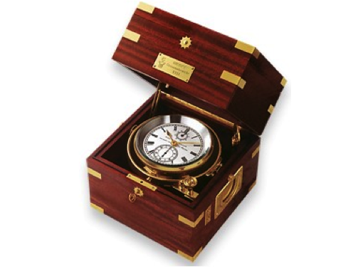
£23,625.00 £27,000.00
This precise mechanical instruments has been handcrafted by WEMPE for more than 60 years. This...
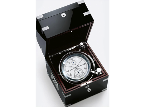
£23,265.00 £27,000.00
This precise mechanical instruments has been handcrafted by WEMPE for more than 60 years. This...
£2,480.00 £2,795.00
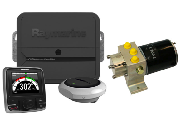
EV-200 Hydraulic Pack - Designed for mid-size power vessels with hydraulic steering. Hydraulic pump included...
Subscribe to our newsletter and always be the first to hear about what is happening.
© 2026 The Wetworks. Website - LucidSynergy